
PoH-Code: poh.27059
Hrib- Loški Potok-Memorial to the Fallen Fighters and Inhabitants of Loški Potok
—
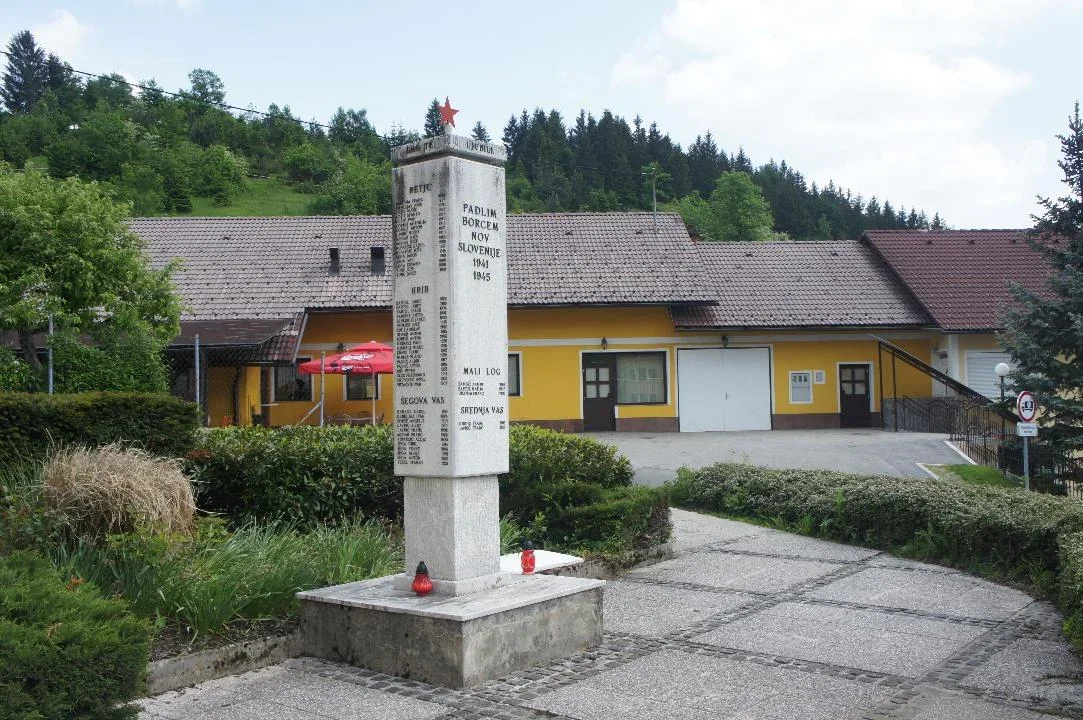
partizanstvo.si / Arhiv Geopedia · CC-BY 4.0 (privzeta licenca) · Preneseno iz Geopedije.
Area of Loški Potok, which includes several settlements, experienced a great amount of occupier violence during the Second World War. Particularly cruel was the Italian military, with the help of local collaborators, during their offensives in 1942, when many locals were shot during their raids or were expelled to concentration camps. Many houses and economic buildings were burned down at that time.
In memory of them, a monument named after the victims from the area of Loški Potok, named after individual villages and with the year of birth, was unveiled near the health centre on Hrib in 1986. In 1999, the monument was moved to a new location near the municipal building, where it represents a completed whole with an arranged environment.
Based on a square shape and dimensions of 144 cm in width and 41 cm in height, a square pillar of 55 cm in side length and 205 cm in height is raised in the centre on a base of 45 cm in side length and 66 cm in height. On three sides, the names and surnames of individuals from individual villages are inscribed. The total height of the monument is 294 cm. On the back side, there is a relief image of a calming shepherd. At the top of the monument is a red five-pointed star.
EŠD 22497. RKD
Translation · AI tier 5
Sources
- Partizanstvo.si — Partizanski spomeniki (#3223) (0ec4acc5-33c4-4868-9de5-b57333abc140) — Partizanstvo.si — Partizanski spomeniki (#3223)
Links
Location & map
Map position available (Point) · spatial accuracy: 4 — Accurate
Textual location description
Spomenik je postavljen na lepo urejeni parkovni površini ob občinskem poslopju občine Loški Potok v središču naselja Hrib na levi strani nad cesto Hrib - Travnik.
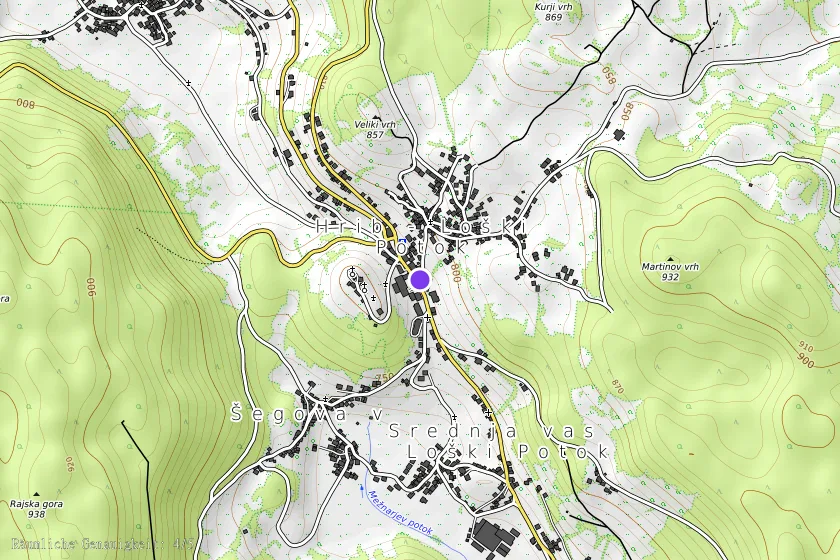
Coordinates (WGS84)45.70079° N, 14.59147° E