
PoH-Code: poh.20969
Ivan Nemec - Vojko
—
Ivan Nemec - Vojko was born on 19 August 1907 in Dragotinči near Sv. Jurij ob Ščavnici. Already in 1941, he joined the Yugoslav People's Liberation Army (NOB). In June 1943, he established a new district committee of the OF and KPS for the Ljutomer-Radgona area. He revived and re-established the organisation SKOJ, ZSM, PFŽZ. In the area of the Slovenian Mountains, he led numerous meetings, informed people about the role of the Communist Party of Yugoslavia (KPJ) in the OF, explained the role of counter-revolution and similar topics. He took care of the development of printing and other propaganda materials.
In February 1944, he left the Slovenian Mountains and went to report to the Central Committee of the KPS about work in northeastern Slovenia. He returned to Styria as secretary of the district committee of the OF for Styria and as a member of the district committee of the KPS for Styria. He was also a member of the SNOS and AVNOJ. He died in 1967 in Ljubljana. Source: Novak, Orešnik, Šticl: Memorials of the NOB in the Slovenian Mountains, p. 87.
The municipal assembly of G. Radgona named the primary school in Radenci after Ivan Nemec-Vojko in 1983. In 2016, the school was renamed to the Kajetan Kovič Primary School.
After the country's independence, the rise of clerical conservatism began, visible in the falsification of the history of the NOB, the trivialisation of the partisans' struggle, the renaming of schools, the removal of monuments, and so on. In Radenci, they voted according to the principle "everything else, but not the red".
Translation · AI tier 7
Sources
- Partizanstvo.si — Partizanski spomeniki (#10581) (2c4a0ea4-1a7c-48b8-92ff-2e17f021454a) — Partizanstvo.si — Partizanski spomeniki (#10581)
Links
Location & map
Map position available (Point) · spatial accuracy: 4 — Accurate
Textual location description
OŠ Kajetana Koviča Radenci, Radgonska cesta 10.
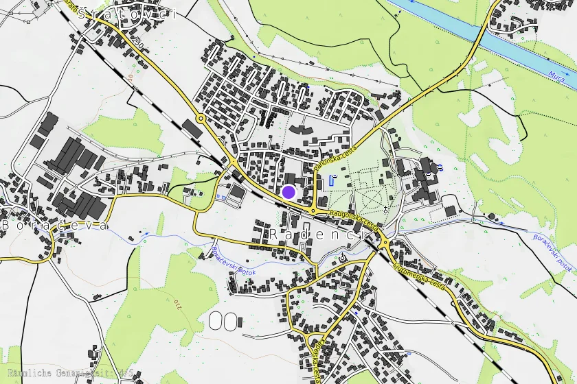
Coordinates (WGS84)46.64268° N, 16.03825° E