
PoH-Code: poh.14542
GOLO - Memorial Site at Mokrc, Memorial to the I. Bat. Šercerjev Brigade - Lukov Battalion
—
partizanstvo.si / Arhiv Geopedia · CC-BY 4.0 (privzeta licenca) · Preneseno iz Geopedije.
Monument falls within the memorial area on Golem, EŠD 5573, which marks the area where from autumn 1942 onwards the battalions of Šercerjeva brigade were encamped. Exactly at this place was the I. battalion of the brigade - Lukov battalion - encamped, commanded by Vidmar Anton, Tone - Luka Suhadolc from Verda near Vrhniki, later proclaimed a national hero.
The memorial plaque made of light stone, measuring 20 x 30 cm, is stored in the building of Dom partizanov Mokrc, as it was previously destroyed by unknown persons. The restored plaque is stored in the Dom.
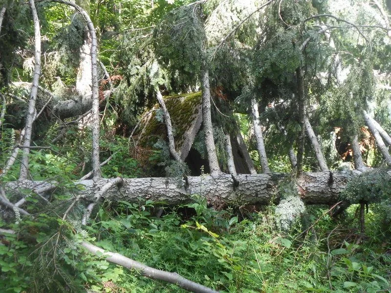
The encampment of Lukov battalion is represented by a concrete bivak, several centimetres above one metre in height, 2.5 m in length, which is currently covered by fallen fir. The fir and other trees in the vicinity of the monument fell during a recent storm.
Note 1:
During the visit on 22. 4. 2023, it became evident that the trees that fell on the bivak had been removed in the meantime (photograph 3/2). The broken memorial plaques were not replaced with another one. We also found a rock, on which it was most likely "stuck" (remnants of concrete on the left rock -- photograph 3/3).
Unknown persons destroyed the plaque in the year 2010.
Translation · AI tier 5
Sources
- Partizanstvo.si — Partizanski spomeniki (#2988) (d6f840bf-4ce8-4c93-b6bc-aecaf5be6252) — Partizanstvo.si — Partizanski spomeniki (#2988)
Links
Location & map
Map position available (Point) · spatial accuracy: 4 — Accurate
Textual location description
Z Iga nas široka in asfaltirana cesta pelje na Kurešček. V vasi Škrilje pri turističnem kozolčku, kjer je smerokaz za Petelinove doline, zavijemo desno in se še nekaj sto metrov peljemo po asfaltirani cesti. Za njo pridemo na makadamsko gozdno cesto, ki nas po oznakah pripelje na cilj. Od vasi Škrilje do Petelinovih dolin je okoli 6 km. Lokacija Lukovega tabora je približno 1 km severno nad Petelinovimi dolinami, GPS koordinate: S 45.89297, V 14.51037.
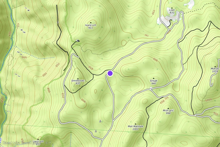
Coordinates (WGS84)45.89280° N, 14.50991° E