
PoH-Code: poh.14309
HRUŠEVO - Memorial to the Fallen Fighters of the Dolomitski Odred
—
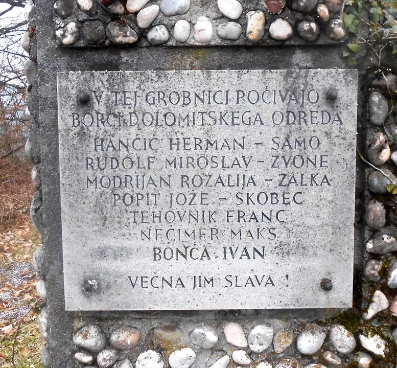
partizanstvo.si / Arhiv Geopedia · CC-BY 4.0 (privzeta licenca) · Preneseno iz Geopedije.
There is no cemetery in EŠD!
The grave is represented by a grave surrounded by a concrete frame, of size approximately 2.00 m x 2.20 m, and represents three parts, of which the left and right are areas for the grave, while the middle represents access to the headstone or to the area for flowers and candles.
The headstone is a concrete slab, of size 1.50 m x 0.80 m, which has in the middle a stone slab of size 0.40 x 0.40 m made of light stone and engraved names. Above the slab with names is a five-pointed star, damaged and repaired, of size 0.40 m, while the rest of the part is covered with pressure from river-rounded stones.
On the plaque there are seven names engraved, although nine fighters were buried. Why is the name of the fighter Ciril Korenčan, who was certainly buried on 8 December 1942, not engraved? It is unknown!
The grave is well maintained, and there is also a wooden bench for resting nearby.
There is no cemetery near the church of St. Jurij.
Source: Vodnik po partizanskih poteh, Ljubljana: Borec, 1978, p. 69.
Translation · AI tier 5
Sources
- Partizanstvo.si — Partizanski spomeniki (#3679) (9140ea5a-dd35-4856-9967-2c991da2c964) — Partizanstvo.si — Partizanski spomeniki (#3679)
Links
Location & map
Map position available (Point) · spatial accuracy: 4 — Accurate
Textual location description
V Hruševu se napotimo proti cerkvi sv. Jurija, ki stoji na stožičastem hribu Prtica. Ob poti na levi, okoli 100 m od zadnje hiše oz. 100 m do cerkve, je na levi strani grobnica s padlimi borci Dolomitskega odreda.
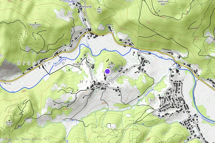
Coordinates (WGS84)46.07208° N, 14.38758° E