
PoH-Code: poh.11365
Šmarje-Sap Cemetery
—
partizanstvo.si / Arhiv Geopedia · CC-BY 4.0 (privzeta licenca) · Preneseno iz Geopedije.
EŠD 17282
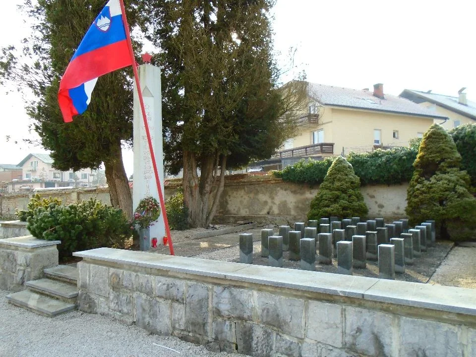
The inscription was written by Peter Levec. The initiator of the arrangement of the cemetery and the erection of the monument was the local committee of the Slovene People's Liberation Army and Partisan Liberation Front (ZZB NOV) Šmarje-Sap, and the designer was Nikolaj Pirnat. Buried in the cemetery are fighters, activists, and civilians who fell during the period from 1941 to 1945. How many victims are buried here is unknown. The largest number of fallen fighters were from the units of the 7th Corps of the Slovene People's Liberation Army and the Partisan Liberation Front (NOV and POS) who fell in the battles around Šmarje in 1944–1945.
Monuments of the Slovene People's Liberation Army (NOB) in the municipality of Grosuplje, edited by Lojze Kikelj, DIC - tozd Grafika Novo mesto, Grosuplje, 1987, p. 209.
The cemetery of the fallen fighters, activists, and civilians was arranged on 22 July 1958 according to the design of sculptor Nikolaj Pirnat. It is represented by a concrete pillar, about 4.5 m high, four-sided with different sizes of individual surfaces, with a cut bottom and top, and with a metallic five-pointed star on top. All of this stands on an arranged plaza, to which access is via three steps, enclosed by a wall about 0.8 m high made of chiseled gray stone and covered with granite slabs. The right part of the plaza represents 35 low square pillars.
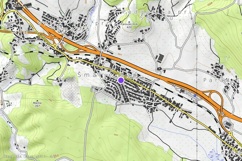
The location of the monument is in the southeast part of the former cemetery, now a park, at the corner between the fire station of the Šmarje-Sap PDG on Partizanska 2 and the Cemetery Road, between houses numbered 14 and 16.
The monument was unveiled in 1958.
Guide to Partisan Paths, Ljubljana: Založba Borec, 1978, p. 111.
Translation · AI tier 7
Sources
- Partizanstvo.si — Partizanski spomeniki (#2584) (09b1b193-3b13-4794-8c98-0fe3fc351546) — Partizanstvo.si — Partizanski spomeniki (#2584)
Links
Location & map
Map position available (Point) · spatial accuracy: 4 — Accurate
Textual location description
Center zaselka Šmarje - Sap, okoli 300 m od cerkve v smeri Cikave, na desni strani.
Coordinates (WGS84)45.97446° N, 14.61524° E